-
 ×
- Início
- Impressões Artísticas ▸
- Artistas ▸
- Categorias ▸
- Estilos Artísticos ▸
- Moldura de imagem ▸
- Todas as molduras
- Molduras barrocas
- Molduras decorativas simples
- Molduras decorativas rústicas
- Molduras com vão de sombra
- Molduras douradas
- Molduras prateadas
- Molduras brancas
- Molduras decorativas pretas
- Molduras com aparência de madeira
- Molduras Shabby Chic
- Molduras decorativas finas
- Molduras decorativas grossas
- Mídia impressa ▸
- Todos os meios de impressão
- Lona Leonardo (cetim)
- Lona Salvador (fosco)
- Lona Raphael (fosco)
- FineArt fosco foto
- FineArt cetim foto
- FineArt baryte da foto
- FineArt foto brilhante
- Cartão em Aquarela Munch
- Cartão em Aquarela Renoir
- Cartão em Aquarela Turner
- Cartão em Aquarela Dürer
- Natural Line Hemp
- Natural Line Rice
- Kozo White, 110g
- Kozo Natural, 110g
- Inbe White, 125g
- Unryu, 55g
- Bamboo, 110g
- Premio Unryu, 165g
- Murakumo Natural, 42g
- Bizan Natural, 300g
- Bizan White, 300g
- Composto de alumínio 3mm
- Vidro acrílico 5mm
- Encomendar conjunto amostra
- Qual é o meio de impressão certo?
Tela
Papel fotográfico
Cartão para aquarela
Natural Line
Papel japonês
Mídias especiais
Mais informações
- Ajuda e serviço ▸
- Contate-nos
- Venda sua arte
- Perguntas frequentes
- Vagas abertas
- Reclamação
- Pedir amostras
- Pedir vales
- Custos de envio
- Tempo de produção
- Sustentabilidade
- Pesquisa de imagem
- Pedidos especiais
- Quem somos nós?
- Política de preços
- Política da empresa
- Compromisso de qualidade
- Distinções
- Chassi para tela
- Passe-partout
- Molduras decorativas
- Vidraça
- Filetes
- Sistemas de montagem
- Mídias de impressão
- Dicas de cuidados
- Marca
- Termos e Condições
- Proteção de Dados
- Direito de Cancelamento
Informações e serviços
Mais informações
Informações úteis
Informação legal
- Loja ▸
- Contato


 Visualizar em 3D/AR
 Adicionar aos favoritos
 Selecione a cor da parede
 Ver o quadro numa divisão


 published Geneva 1780 - (MeisterDrucke-102731).jpg "Itália, de \"Atlas de todas as partes conhecidas do globo terrestre\", de Guillaume Raynal (1713-96), publicou Genebra, 1780")

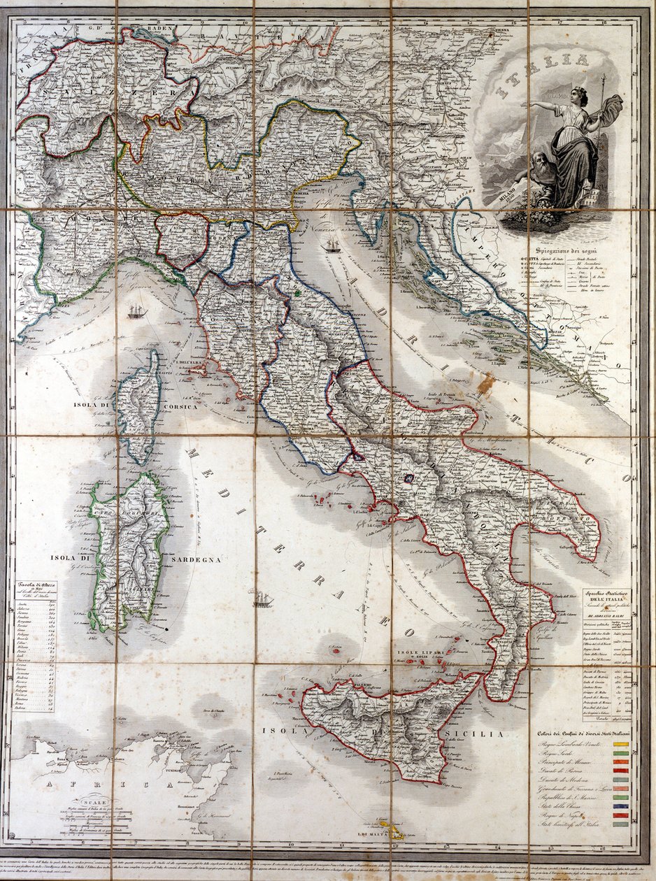
.jpg "Mapa de Itália, com a Córsega, a Sardenha e a Sicília")


_(Engraving_-_(MeisterDrucke-949053).jpg "Mapa do Reino de Nápoles (Itália) (gravura)")

.jpg "Mapa de Itália, com a Córsega, a Sardenha e a Sicília")


.jpg "Mapa de Itália, Córsega e Sardenha (gravura")


_(etching_-_(MeisterDrucke-1005232).jpg "Mapa do Reino Neapolitano (Itália) (gravura")
.jpg "O Mar Midland E Norte Da África. Medida 1")


.jpg "Mapa do curso do rio Danúbio na Alemanha")


.jpg "Menina a fazer malha, a vigiar uma criança pequena no berço")

 Surrounded by her Ladies-in-Waiting 1855 - (MeisterDrucke-100747).jpg "A imperatriz Eugénie (1826-1920) rodeada pelas suas damas de companhia, 1855")

 c1865 - (MeisterDrucke-76268).jpg "A estrada para Bas-Bréau, Fontainebleau (Le Pavé de Chailly), c. 1865")
 1914-18 (see also 64185 64186) - (MeisterDrucke-96418).jpg "Os nenúfares - As nuvens (lado direito), 1914-18")


.jpg "Rapaz com um corvo")


.jpg "Cartaz para a 14.ª Exposição da Secessão de Viena, 1902")
.jpg "Carne de vaca: diagrama que representa os diferentes cortes de carne")
.jpg "O fresco dos golfinhos na casa de banho da rainha, Cnossos, Creta 1550-1450 a.C.")

 +43 4257 29415
 support@meisterdrucke.com
 Mo-Do: 7:00 - 16:00 | Fr: 7:00 - 13:00